+86 15898932201
In water resource management and ecological protection efforts, it is crucial to build a technical system that covers the entire process of "water pollution control, aquatic ecological monitoring, and water disaster early warning". The River Level Measurement solution, by scientifically deploying distributed hydrological monitoring stations along rivers and enabling collaboration among these stations, can fully integrate hydrological data, achieve network formation, cloud connection, and practical application. It provides reliable technical support for river development planning, river ecological protection, flood disaster prevention and control, and helps management authorities improve the refinement level of water resource management.
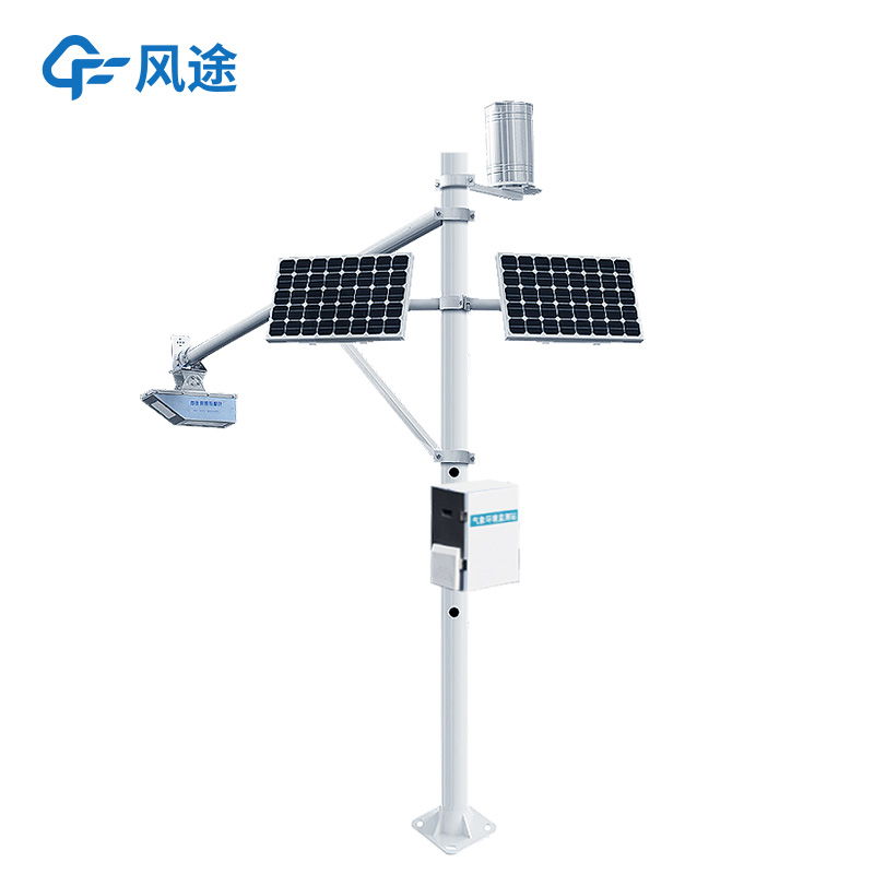
With distributed hydrological monitoring stations as its core, the system deploys monitoring equipment and data transmission devices at key river locations—such as tributary confluences, densely populated coastal areas, and flood-prone sections—to monitor the core parameters of river operation in real time. Among these parameters, flow rate and velocity data are accurately collected by professional instruments, dynamically reflecting the flow state of river water; rainfall and water level data are recorded in real time, providing key references for water disaster early warning; water quality monitoring equipment continuously tracks indicators such as dissolved oxygen, pH value, and chemical oxygen demand in the water. If abnormalities are detected, potential water pollution hazards can be identified in a timely manner; on-site cameras enable visual monitoring, allowing managers to intuitively grasp the surrounding environment of the river and the appearance of the water body—such as whether there are floating objects or abnormal water color.
The system is compatible with a variety of industry-standard protocols, ensuring that all types of monitoring data are stably uploaded to the unified platform of management authorities via wireless networks. This effectively breaks down data silos and realizes centralized management of multi-source data. This platform is fully functional: it can present parameters such as water quality, flow rate, and water level in clear visual forms like charts and curves, allowing managers to keep track of the real-time dynamics of the river at any time; it also supports remote access to real-time data and historical records of each monitoring station, enabling daily monitoring to be completed without on-site personnel on duty.
The system's early warning function can automatically trigger an alarm when monitoring data exceeds the normal range based on preset parameter thresholds—for example, sending SMS alerts or platform pop-up reminders. This helps managers become aware of abnormalities in the first place and take timely response measures such as intercepting pollution and reinforcing embankments, preventing the expansion of water pollution incidents or the spread of flood disasters. By summarizing and analyzing historical monitoring data, the system can also provide scientific data support for river development planning, water resource allocation, and river ecological restoration, promoting the development of river management in a more efficient, accurate, and sustainable direction.
Article address:https://www.sqqx.net/en/news/737.html