+86 15898932201
Water is the source of life and also an important economic resource and ecological element. However, floods and droughts (such as floods, waterlogging, and droughts) have always been major natural disasters facing humanity, posing serious threats to people's lives and property safety and economic and social development. Therefore, accurate, real-time, and continuous monitoring of hydrological elements (such as water level, flow velocity, discharge, rainfall, etc.) of rivers, lakes, reservoirs, and other water bodies is the foundation for flood control and drought relief, water resources management, water environment protection, and water conservancy project construction.
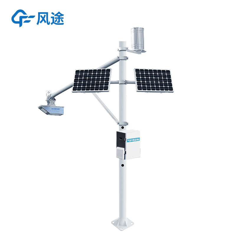
The Water Level Monitoring Station is an integrated device that uses radar technology for remote, non-contact, automated monitoring of hydrological elements. It consists of a radar sensor (core), data acquisition unit, power supply system (solar panel + storage battery), communication module (4G/5G/NB-IoT, etc.), and mounting pole.
Water level monitoring adopts the Frequency Modulated Continuous Wave (FMCW) radar principle. The radar antenna emits a microwave with continuously changing frequency towards the water surface, and the wave is reflected back to be received by the antenna after encountering the water surface. Since the propagation speed of electromagnetic waves in air is known, the distance between the radar antenna and the water surface can be accurately calculated by computing the frequency difference between the transmitted and received waves. The water level value is obtained by subtracting this distance from the known elevation of the antenna.
Flow velocity monitoring adopts the Doppler radar principle. The radar emits microwaves of specific frequency towards the water surface. When the waves contact the flowing water surface (especially surfaces containing floating objects or tiny ripples), the frequency of the reflected waves will change (Doppler effect). By analyzing the amount of frequency change (Doppler frequency shift), the surface velocity of the water flow can be calculated.
The radar hydrological station integrates water level radar and flow velocity radar. The system calculates the cross-sectional area of water flow through water level data, then combines it with the measured surface velocity, and automatically calculates the real-time discharge through built-in hydraulic models (such as exponential method, velocity-area method, etc.).
The device can also be equipped with a radar rain gauge, which retrieves rainfall intensity and cumulative rainfall by scanning the drop size distribution of rainfall with radar waves, making it less likely to clog than traditional mechanical rain gauges.
Compared with traditional monitoring methods, the Water Level Monitoring Station has outstanding advantages:
No direct contact with water bodies, completely avoiding environmental influences such as sediment, floating objects, corrosion, and freezing, resulting in longer service life and high stability.
Only a stable installation point on the shore (such as a bridge or bank slope) is needed, without underwater construction, greatly reducing construction costs and maintenance risks.
Fast measurement speed, capable of data refresh at the second or even millisecond level, able to capture instantaneous changes in water level and rapid evolution of flood peaks.
Multi-functional in one station, capable of simultaneously monitoring multiple parameters such as water level, flow velocity, discharge, and rainfall, providing more comprehensive hydrological information.
Fully electronic operation without mechanical wear, suitable for long-term operation in harsh environments and unattended stations.
Article address:https://www.sqqx.net/en/news/757.html