+86 15898932201
Landslides are common geological hazards in mountainous areas, characterized by their sudden occurrence and highly destructive nature. They pose a serious threat to people's lives, property, and the operation of infrastructure. Landslide initiation is often closely related to factors such as rainfall, earthquakes, and artificial excavations. The movement process can trigger a series of secondary disasters, including building collapses, road interruptions, and river blockages. Therefore, conducting effective surface displacement monitoring is crucial for the early identification and warning of landslide risks.
GNSS (Global Navigation Satellite System) technology is currently one of the primary methods used for landslide monitoring and early warning. The fundamental principle involves deploying GNSS monitoring stations on the landslide body and in surrounding stable areas. By continuously receiving satellite signals, the system calculates real-time 3D coordinate changes of each station. When the landslide body undergoes minor displacement, the monitoring stations installed in the deformation area move accordingly, while the reference stations in stable areas remain fixed. By comparing the positional differences between them, the system can accurately detect millimeter-to-centimeter-level displacements of the landslide mass, including the direction and rate of movement. Based on this data, if continuous accelerated deformation or displacement exceeding preset thresholds is detected, the system triggers different levels of early warning messages, providing valuable time for evacuation and emergency response.
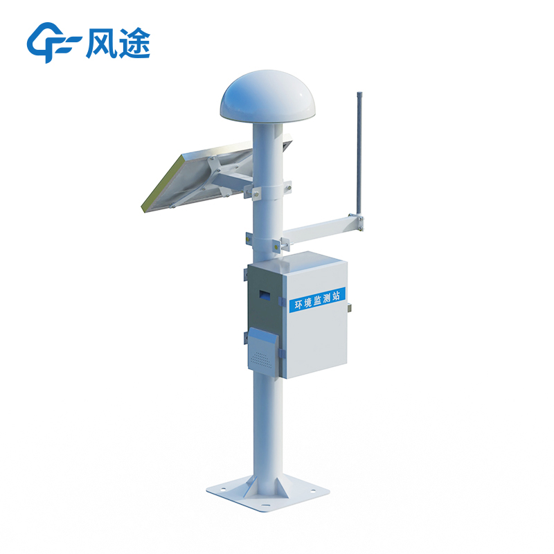
The landslide monitoring and early warning system is an automated framework centered around GNSS monitoring stations, integrated with various sensors and communication technologies. The system consists of four main components: field monitoring stations, data transmission networks, data processing centers, and an early warning information dissemination platform. Field monitoring stations include GNSS receivers, antennas, power supply units, and communication modules installed on the landslide surface. To ensure monitoring reliability, key locations often employ dual GNSS receivers in a redundant configuration. The monitoring stations transmit raw observation data in real-time to the data processing center via wireless communication networks (e.g., 4G/5G or satellite communication).
At the data processing center, specialized software utilizes differential algorithms to process the data, eliminating interference such as atmospheric delays and satellite orbit errors, thereby obtaining high-precision displacement time series. The system can automatically analyze displacement trends and assess risk levels based on predefined warning models (e.g., displacement rate thresholds, acceleration changes). Once warning conditions are met, the system disseminates alerts through various channels, including platform interfaces, text messages, and broadcasts, to relevant departments and affected areas.
Article address:https://www.sqqx.net/en/news/782.html