+86 15898932201
Slope Monitoring Radar is based on an arc-shaped synthetic aperture radar system and phase differential interferometry technology. Weighing less than 10 kg, it enables non-contact, high-precision monitoring of slopes, dams, and mountains, eliminating the threat of secondary disasters to rescue personnel and equipment.
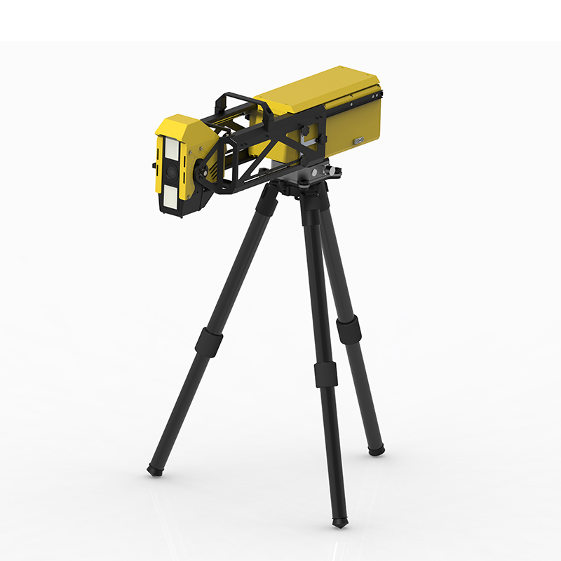
Slope Monitoring Radar is a non-contact remote sensing monitoring device specifically designed for disaster relief scenarios. Based on an arc-shaped synthetic aperture radar system and frequency-modulated continuous wave signal, combined with phase differential interferometry technology, it can continuously monitor targets such as slopes, dams, mountains, and buildings with high precision. Unlike traditional monitoring methods, this radar does not require any sensors installed at the monitoring point; it only needs to have line-of-sight with the monitored area to collect data, significantly reducing the complexity of emergency deployment.
Portability is one of the core advantages of this device. Weighing less than 10 kg and folded to a maximum size of less than 50 cm, it can be placed in a 24-inch carrying case, meeting the requirements for onboard baggage handling in civil aviation. The on-site deployment time is less than 2 minutes, supporting rapid tripod setup, and can be carried or carried by a single person into the rescue site. Some models also adopt an edge computing architecture, integrating information processing, positioning and orientation, and wireless communication functions into the main unit, eliminating the need for external processing equipment.
In terms of monitoring capabilities, Slope Monitoring Radar boasts 360° omnidirectional coverage, with a maximum detection distance of 4 to 5 kilometers and deformation measurement accuracy better than 0.1 millimeters, enabling the detection of displacement changes in the early stages of geological creep. The equipment employs microwave penetration technology, unaffected by harsh environments such as rain, snow, fog, smoke, dust, and fire, and can operate stably in ambient temperatures ranging from -40℃ to 55℃. The data acquisition cycle can be adjusted between 0.5 and 4 minutes to meet the data update frequency requirements of different scenarios.
Slope Monitoring Radar has clear application value in the field of emergency rescue. At geological disaster sites, the equipment can monitor the deformation trend of landslides in real time, providing early warnings of potential secondary collapses. Water conservancy departments can use it to detect the deformation of dikes during the flood season or after earthquakes, providing data support for flood control decisions. In open-pit mines and along major transportation routes, the equipment can be used for slope stability monitoring during construction. Currently, portable micro-change monitoring radar systems have been deployed in the management of geological disaster hazards along highways in areas such as Baise and Hechi in Guangxi. Through continuous dynamic monitoring, these systems have successfully provided early warnings of slope collapse risks, ensuring the safety of construction personnel and equipment.
Article address:https://www.sqqx.net/en/news/889.html