+86 15898932201
The Hydrological Monitoring and Forecasting System employs K-band planar radar technology to perform non-contact measurements of water levels and flow velocities. Data collected by sensors is transmitted wirelessly to a central station for storage, analysis, and early warning processing. This system is suitable for various hydrological monitoring applications, including rivers, irrigation canals, reservoirs, and drainage networks.
The Hydrological Monitoring and Forecasting System is an automated hydrological monitoring solution built upon Internet of Things (IoT), telemetry communication, and computer technologies. Its primary function is the real-time acquisition and processing of hydrological parameters—such as rainfall, water levels, and flow rates—within a river basin. The system is widely deployed in rivers, irrigation canals, reservoirs, underground drainage networks, and flood warning systems, providing essential data support for flood control operations and water resource management.
The core data acquisition component of the system utilizes K-band planar radar technology to perform non-contact measurements of water flow velocity and water levels. The radar sensor emits high-frequency electromagnetic waves toward the water surface; upon receiving the reflected signals, it employs the Doppler effect to calculate the surface flow velocity. By integrating the ranging capabilities of Frequency Modulated Continuous Wave (FMCW) radar, the system also achieves precise water level measurements. The data collected by the sensors is processed through built-in algorithms in conjunction with the cross-sectional area of the water channel to output real-time instantaneous flow rates and cumulative flow volumes. This non-contact measurement method remains unaffected by environmental factors such as temperature, sediment, pollutants, and surface debris; it features low maintenance requirements and is well-suited for deployment in a wide variety of complex outdoor environments.
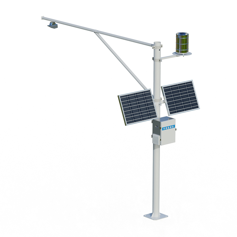
The overall architecture of the Hydrological Monitoring and Forecasting System consists of three main components: remote telemetry stations, communication channels, and a central station. The remote telemetry stations serve as the front-end data acquisition units and are typically deployed at critical cross-sections along rivers, within reservoir dam areas, or along irrigation canals. The equipment housed within each station includes sensors such as radar water level gauges, radar flow velocity meters, and tipping-bucket rain gauges, which work in conjunction with a data acquisition terminal to perform data pre-processing and local storage. The power supply system typically employs a solar power solution backed by a battery reserve, ensuring the system can operate continuously over extended periods in outdoor locations where grid power is unavailable. Regarding communication channels, the collected hydrological data is transmitted in real-time to the central station via various transmission methods, including 4G, 5G, LoRa, GPRS, or the BeiDou Satellite Navigation System. The central station is equipped with data processing servers and a management software platform; it is responsible for receiving data from various remote telemetry stations, performing data storage, analysis, and visualization, and issuing multi-level warning signals based on preset thresholds.
The warning function of this system plays a crucial role in flood control operations. Administrators configure multi-level warning thresholds for indicators—such as water levels and rainfall—within the platform. When monitored data exceeds these critical thresholds, the system automatically pushes notifications via SMS, in-app pop-ups, or broadcast messages, alerting relevant personnel to take timely countermeasures. In addition to issuing warnings, certain system configurations can also interface with sluice gate operators and drainage pumping stations to enable remote automated control, thereby minimizing the need for manual intervention and reducing response times.
The deployment of this hydrological monitoring and forecasting system significantly enhances the level of automation in hydrological operations. Traditional manual observation methods require personnel to visit monitoring sites periodically to collect data—a process that lacks timeliness and entails safety risks. In contrast, the automated hydrological monitoring system enables continuous, unmanned data acquisition and real-time transmission around the clock. It updates hydrological data every five minutes and immediately uploads updated information whenever water level fluctuations reach a predetermined magnitude, thereby providing a timely and accurate data foundation for flood control command and water resource allocation. Furthermore, this system serves as a core component of the infrastructure supporting the development of "Digital Twin" water management systems and modern hydrological station networks.
Article address:https://www.sqqx.net/en/news/879.html